
I took a bit of a break from the TN NG911 project. I’ve had a lot of random thoughts about direction and “what does this need to do” as in QGIS Plugin or more work into the database…or both. Anyway – more on that later.
A few weeks ago a client popped up and went “Hey we have to deliver data to RapidSOS“. Soon I was on a three way call and “We need your data in ESRI Format”. So for those of you just tuning in we’re running a 911 addressing database with postgis, qgis, and probably geoserver shortly. We’ve been delivering data to the dispatch system as shapefiles (I know) and to the state we’ve been doing Geopackage. Smooth as butter and it’s been running 5 years with no hiccups or down time.
RapidSOS uses ESRI’s File Based Geodatabase format. I probably could make the case that something this important shouldn’t rely on a proprietary format – but we can work around that now. I’m not a 911 expert but from what I understand the RapisSOS system brings your mobile device into 911 and provides a usable location. So how does my client who doesn’t still own a supported copy get data to Rapid SOS?
QGIS can create (and edit) ESRI’s File Based Geodatabase.
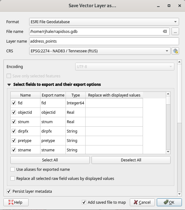
We did the export and I heard nothing. Usually for me “no response means no complaints”. Yesterday I had the chance to see it in action in the Dispatch Center. No one noticed or cared this data was spit out of QGIS. Data is Data. A win is a win.




