by rjhale | Jul 22, 2024 | Lidar, QGIS
So this will be my last “New Class” announcement for a bit. Back in the spring of 2024, I taught a 4 hour QGIS and LIDAR class at the TNGIC meeting (State of TN GIS meeting). I ran through it and shelved it and now I’m fixing the problem spots and...

by rjhale | Jul 8, 2024 | GRASS, Lidar, QGIS
I typically spend June wondering about what I’m doing, have done, and need to do work wise. One thing I keep thinking about is “the old days”. By old days I mean the start of my career which was doing a lot of Watershed Mapping. Back in the mid...
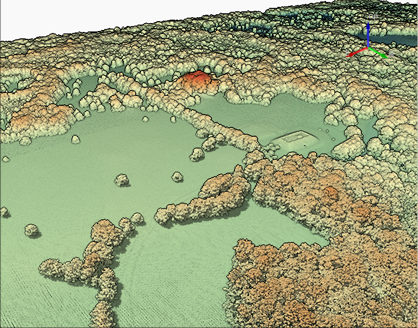
by rjhale | Apr 26, 2024 | Forestry, Lidar, QGIS
At the TNGIC conference I did a workshop on LIDAR and QGIS. I was completely blasted out by ESRI’s Avenue for the Web class but I had a few souls come in and take a look at it. I finished it off with “I don’t use LIDAR that much”....

by rjhale | Mar 27, 2024 | Lidar, QGIS
So – if you’re coming to the 2024 TNGIC (TN Geographic Information Council) meeting (April 9-11 2024) to talk about how no one understands what you do……I’m doing a workshop. What workshop? It’s a new workshop. QGIS and LIDAR data....

by rjhale | Dec 12, 2023 | Lidar, QGIS
I’m old. If you look at my past mapping history I was helping create DEMs (or DTM’s if you will) with Photogrammetry folk. It involved a lot of Aerial Photography and control and weeks. Then LIDAR hits. TN has an abundance of LIDAR and I rarely have any...
by rjhale | May 3, 2023 | Lidar, QGIS
Did you ever get writers block? I did..well and still do. So after spending a few weeks “stuck” – I’ve decided to work my way through (as much as I can) the changelog for QGIS 3.30. I may talk later on “small business owner’s...
