aaaand it’s back up. I would share the URL but it’s not quite ready for prime time. It’s close though!
So much of my life this year has been “I didn’t know there was such an interest in <fill in the blank> (addresses, transportation, wildlife animal tracking, etc). Here’s the Transportation story.
Through a long series of events I won’t bore you with there was a mapping party in town a while back with Outdoor Chattanooga. It was interesting because we only really cared about one thing – Transportation: Bikes, Buses, and Walking. I was told it was a Multimodal transportation exercise (or something like that). In other words you want to get across town and not use your car. I have gotten to that point in my life where I don’t bike enough but I’m really hating being in a car. So we spent the day editing and marking bike lanes in OpenStreetMap. OpenStreetMap you say? Yes – There weren’t the politics involved in acquiring a shapefile from the City/County, we could do what we needed with it, and the editing tools are free and cross platform. We received a GTFS (General Transit Feed Specification) file from CARTA and we started trying to get OpenTripPlanner up and running.
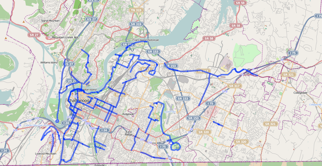
Bike Lanes in Chattanooga
OpenTripPlanner Is a multimodal trip planning software. It was developed by TriMet. OpenSource. It mainly uses OpenStreetMap but you can use shapefiles if needed. It’s just really slick. Instead of paying for some very expensive proprietary software you can use this. We’re running it off a linode VM on Ubuntu 12.04 LTS. OTP takes Elevation Models, transportation data, and the GTFS file to plan trips across the city. Want to ride your bike and catch the bus? Walk to the Bus stop and then to ride to your destination? You can plan it all out with approximate times and bus fares.

OTP Instance running in Chattanooga
The example runs from Downtown to my house. I rode my bike from downtown along the path given. Because I picked the quickest route it takes me up a hidden path I put into OSM which are steps into my neighborhood that go through the woods. I could have picked about any different way to get there – from Walking to bus to bike (or all Three). I even get a nice graph of the elevation from Downtown to my house.
Anyway – there are a few more things I need to do to make this ready for prime time. I’m not sure I have all of OTP set up correctly – I need to configure Tomcat to handle the web portion of this and I need to check some tags in OSM. Overall – not bad. It will make a great addition to the city (hopefully)


