by rjhale | Dec 14, 2022 | Lidar, QGIS
A while back (like a year and a half ago) I did a post on QGIS and LIDAR here. Why am I worried about LIDAR when I still hardly ever use it? Well – TN has a whole state’s worth of LIDAR data and people need to utilize it. There were a number of weird...

by rjhale | Feb 15, 2022 | Lidar, PDAL, QGIS
I did a demo the other day for some foresters and I almost wanted to walk into traffic by the end of it. Not because of anything with QGIS and LiDAR – but I think I finally got “Virtual Fatigue”. Part of the demo worked amazingly well. If...

by rjhale | Feb 18, 2021 | Lidar, QGIS
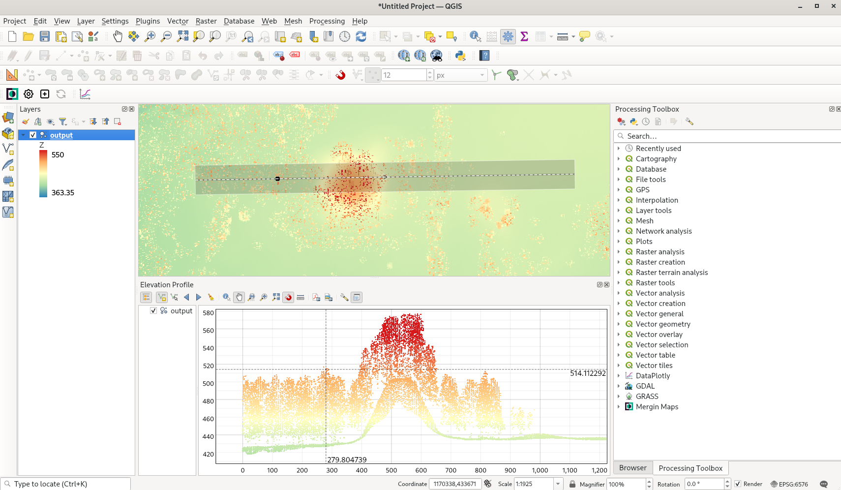
I usually try to not write about the “pre” release (technically it’s master) of QGIS. Of course I went and said “HEY I want to talk about QGIS at a conference” and a large part of what I wanted to talk about was the new release. Which...
by rjhale | Dec 18, 2019 | GRASS, Imagery, Lidar
I know – I’m running behind. So look at these 12 days as either “hints” or “tools”….or both. Being a consultant I walk into some weird situations with data and clients – so it helps to take a full complement of tools...
by rjhale | Jul 6, 2017 | GRASS, Lidar, Tennessee
Part 1 Part 2 And now for Part 3. So something exciting happened. If you’ve been keeping up with the TN GIS Data site you’ll notice a lot more data has been released in uncomfortably HUGE zip files. I downloaded two counties worth and have been exploring...
by rjhale | Jan 5, 2017 | Atlanta, Georgia, Lidar
LIDAR is a hot topic in Georgia these days. So – for the January 2016 Luncheon more LIDAR. “LIDAR Updates – Changes in the Technology and Coverage” Speaker Name: Ernie Smith Presentation Summary: Like all Technology LiDAR has become very...
