A while back (like a year and a half ago) I did a post on QGIS and LIDAR here. Why am I worried about LIDAR when I still hardly ever use it? Well – TN has a whole state’s worth of LIDAR data and people need to utilize it. There were a number of weird things I experienced in the first post like the vertical datum not being recognized and TN releasing all their data in zlas format. Both fixable – but it was just more time and effort and all I want to do is be lazy and things to just work.
So what has happened since then? Well – we are up to QGIS 3.28 and the USGS has released all their 3DEP LIDAR data through the LIDAR Explorer (no more dealing with zlas).
Early this year I was asked to speak remotely about QGIS and LIDAR from someone that had seen the talk I did back in 2021. I decided to switch it up and do something “more fun” which ended up being LIDAR data of the Pinson Indian Mounds.
With the data in LAZ/LAS it became ridiculously easy to drag and drop it in and just start “doing things” in the 3D viewer. QGIS 3.28 has become exceptionally easy to use for LIDAR visualization. That was my “speaking tour” the last half of this year: you too can use QGIS to look at your free LIDAR in TN. It was always an ESRI audience BUT this time I got some grumbling of “YES” and “What is the license that lets you do this?”. Well – there isn’t one. It just works.

Lutra Consulting/North Road/Hobu have done a round of crowdfunding events to make this work. I don’t know how much was raised (because I’m lazy and haven’t looked it up) but it was cheap (when compared to commercial efforts) to get us here. I think NRGS was able to contribute a small amount to at least two of the fund raising efforts. Probably the most exciting thing currently for me is the elevation profile panel. Draw a line and look at your LIDAR file.
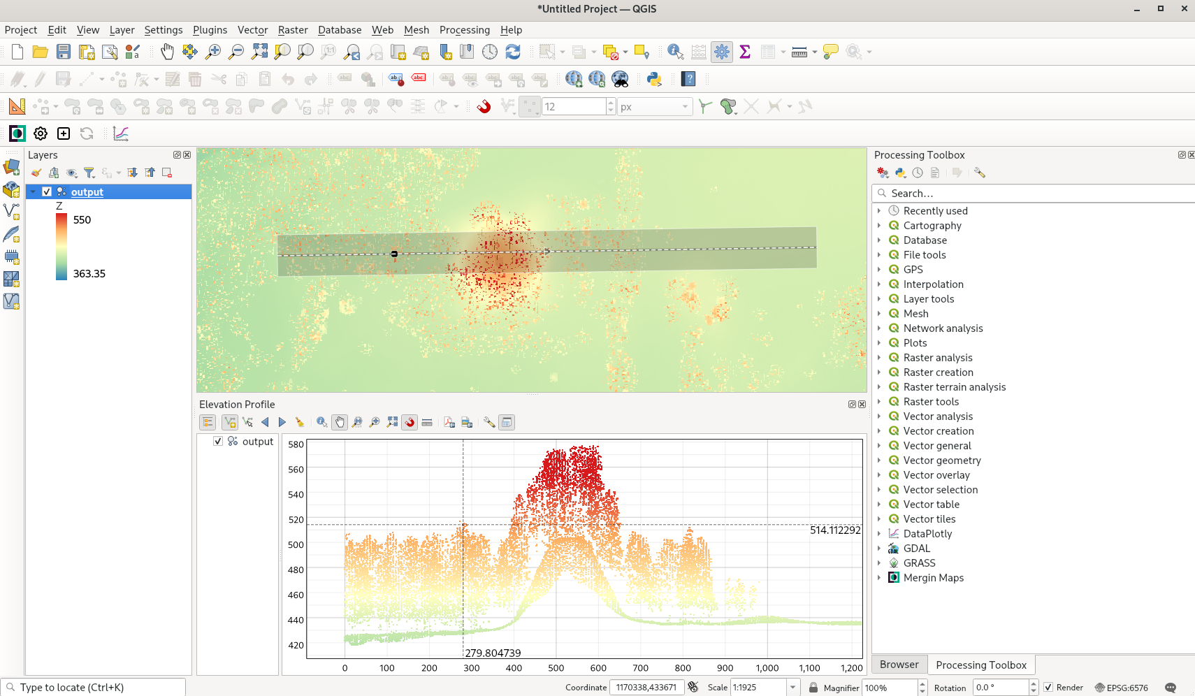
Things really stick out with the profile tool – much like this tree covered Indian mound.
This summer I was looking into drones and it hit me that between opendronemap and QGIS and pdal – you’ve got a solid platform – or at least I think you’d have a solid platform. I still don’t have a drone. Who knows – maybe one day……. BUT – if the one day did happen the next update (last crowdfunding campaign) to all of this are some tools to work with LIDAR in QGIS.
It’s a lot – and I know this was way less than my last blog but for me there’s less to worry over. Simply get some LAS/LAZ data and drop it into 3.28 and start playing around.


