
I’m a business partner with Fulcrum. Sometimes cool things happen and I get to play with with Fulcrum outside of “normal working hours” – Like Fulcrum’s Community Program. So what am I doing with Community?
My volunteer time is a closely guarded thing. I’ve scaled back – but I’m still helping Caribbean SEA. “…But Randy that’s in the Caribbean….” – Well actually they are based out of TN and do quite a bit of work with local watersheds. The big one right now is the Mountain Creek Watershed.

There has been a dream about a mobile application for a while. We’ve had some starts and some misses but that’s alway been a want: Something stupid simple that will let people go out and collect data about a stream. Plus a GIS of some sort. We’ve used a lot of maps but haven’t tried to actively maintain a Geographic Information System.
The Application is running off Fulcrum’s Community Plan – which means we can stick as many people on there as we need and Fulcrum was awesome enough to donate the plan. Right now we have about 40 people out collecting data in the world. The plan is to get this up to 50 people before we go “THIS IS A THING” and push it to as many people as we can. What type of data are they collecting? Data about pollution and issues around a stream. Data that is more “soft” as in “How do you feel about this area” and data like “Do you see trash in the water or on the banks” and “Do you see fish?”. Data that is pretty concrete as in water tests for turbidity and fecal coliform.
The App is in three parts:
- An Emergency (you find an active problem)
- A Survey (you describe the stream and it’s surroundings)
- Water Sampling (you record some information and then perform a water test).

The big problem for me – trying to learn how people like the application or don’t like it. I’ve had a few ideas and I thought they were brilliant – only to have the users go “That’s Terrible”. So I started a Google Group. I send out periodic emails and remind people to sync the app for more changes and attempt to engage (enrage as I call it) the users to make suggestions on what data we need to record we aren’t recording….. or how to make the app more self explanatory.
So far what have we done?
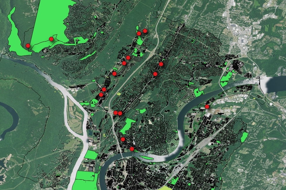
We’re leveraging a lot of data:
- We have a GIS on the Watershed residing in PostGIS/QGIS.
- We have data getting shoved into Fulcrum (the red dots)
- We have LIDAR Data so I can break out the watershed into ever smaller pieces.
- We’ve got a running record of data that is now digital.
- We’re also collecting data in the Caribbean. Yes – How generic can I make this and still make it useful? We want one app to rule all the data collection.

Things I am working on around the data collection:
- Assigning a value to the user experience so we can “rate a stream”.
- Keeping the app up to date
- Data clean up.
So – if you’re on the Facebook – Look them up: https://www.facebook.com/CaribbeanSEA/
If you happen to find yourself in St Lucia – Track them down.
If you happen to make it into Chattanooga – Buy some gear: http://gearcloset.org/




