I hardly ever talk about fulcrum except on twitter. I’ve had a license for a while and I use it somewhat randomly depending on the client. This last year I’ve been ‘perfecting’ (for lack of a better term) my toolset as a consultant. Which for anyone that reads this blog or stumbles upon it I spend a ton of time on QGIS and other things. This year you’ll see more stuff on Fulcrum and PostGIS and a few other assorted tools. Even ArcGIS.
I started using Fulcrum a few years ago. There was a job in the USVI where it became crucial because it ran on everything and it was simple enough to deploy a field crew with an hours worth of training. At that point I started growing disenchanted with high end GPS equipment and liked the idea of data collection on my phone. Accuracy? There are ways to satisfy that itch if you love your big yellow GPS unit.
Last night started me thinking on how I’m going to move the forestry guys to tablet based data collection. I’m not a forester. At best I’m a hack geologist that found more love with maps than with rocks. This spring I had a chance to go out and work with them on a job. I learned two things – A. They love pencil and paper (no batteries) and B. I’m horribly out of shape.
The short story on their timber inventories has been:
- Get a property owner with timber to inspect
- Get me to generate a ‘grid’ that they load into GPS units
- They walk and inventory the timber at those points with pen and paper
- Data is entered manually and a report is generated

It makes me tired. Sorta. I’m a fan of what works but there needs to be an easier way.
So my plan is to move this into Fulcrum. The one problem I’ve not sat down to look at until this week was repeatable fields. There is excellent documentation on the fulcrum site and I sat down and started reading and watching videos. Once I get this nailed down I’ll look at tossing the app up for other people to use. Of course I’m assuming their workflow isn’t so different no one can use it (again – I’M NOT A FORESTER)
Right now I know they need three things in the report: the GPS Identification, Tree type, Tree Diameter. There is more than that – but for now it will be a start to prove the concept. If I prove the concept maybe we move into digital data collection finally.
It’s easy to build apps with fulcrum – it’s all Drag and Drop. It does take a little bit of planning though

For a start I’m adding three fields: name, type, and size. The name will be the ID of the plot point (which I generate). Type and Size will be repeated for each point. There might be 1 tree. There might be 15 trees. Because this field will be repeated…..I’m going to put them into the “repeatable” widget/field. In this case if you look at the image above I’ve called the repeatable widget ‘Tree Data’. You drag and drop a field under the repeatable section. Once it is there – you can keep using it over and over to fill out your data.
Because the GPS points are generated in QGIS they don’t need to be collected – but they do need to be displayed in the application. They are adding more information to data that already exists (think of doing a fire hydrant survey where you’ve already surveyed fire hydrant locations but you need to know color or fittings). So I upload the gps data into fulcrum:
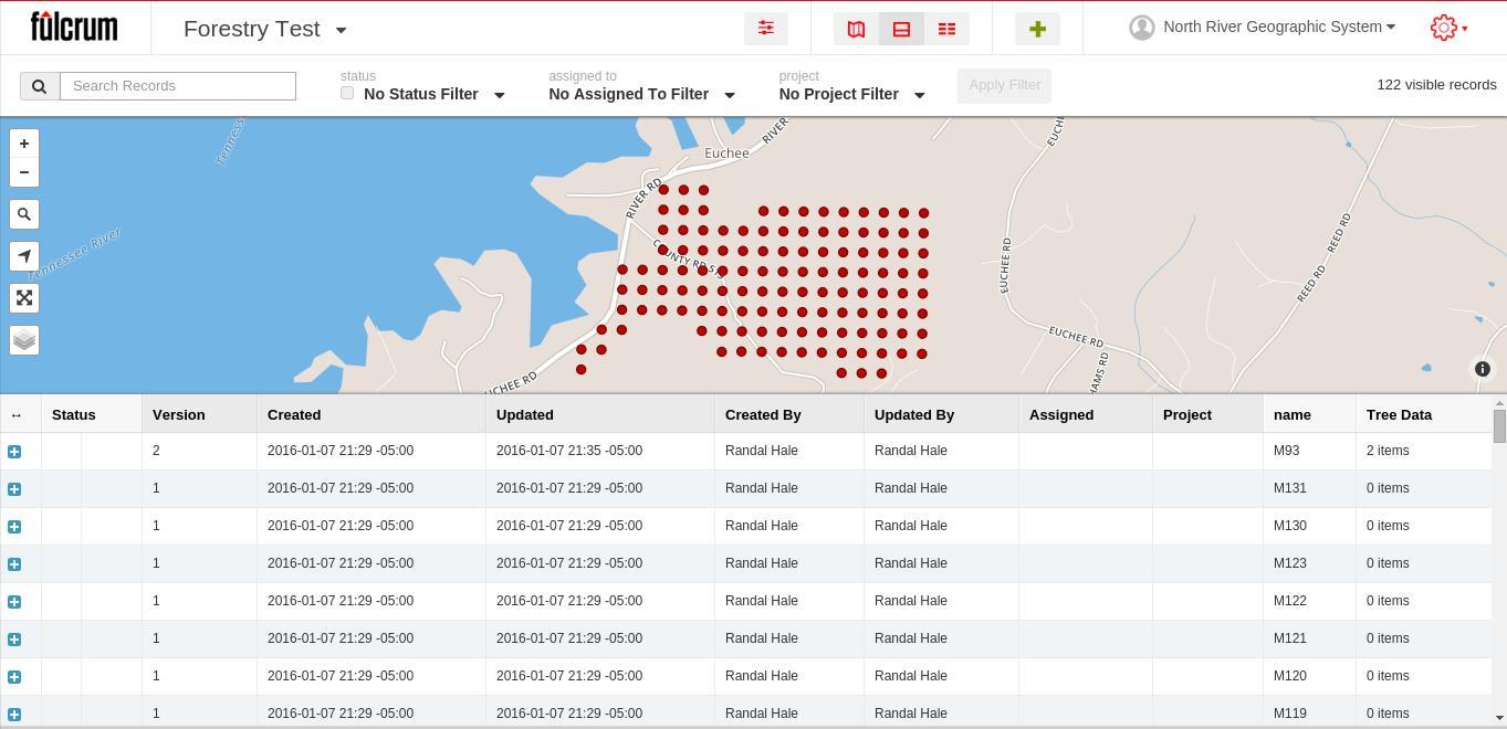
The saving grace in the US Virgin Islands was Fulcrum would run on anything. When I sync this to my phone my brand new app looks like:

So I’ve generated all these in QGIS. Now if you touch one of the points you get a name (or say you walk to a point):

If I touch it again I can edit the attribute data of the point. The point has a name – it just needs a type and a size entered the repeatable field (called Tree Data).

When I tap Tree Data (the Repeatable field) you see your two values to be entered:
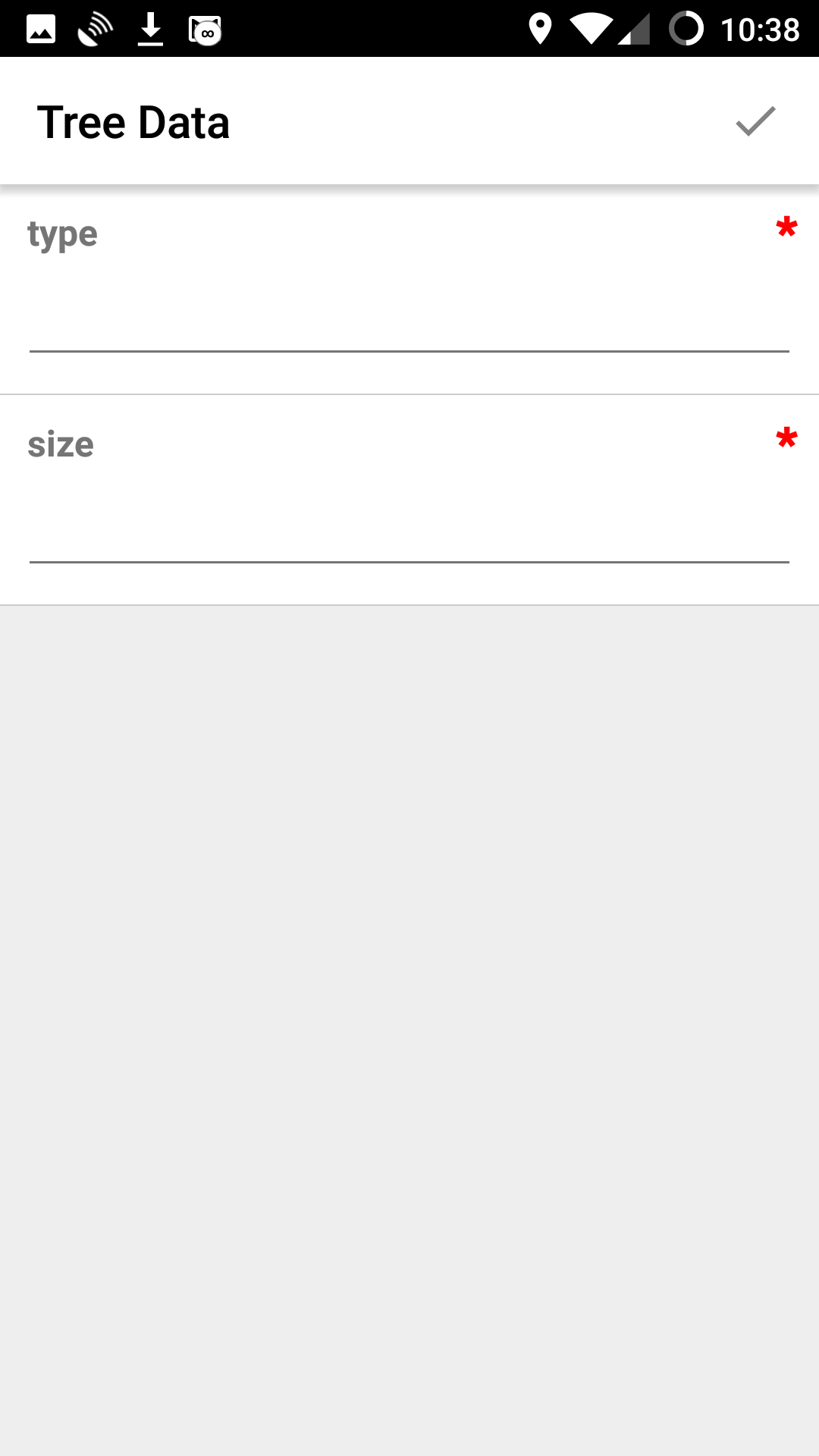
I just start adding data. Once I’m done with this type of tree and size of tree – I click the check mark. I want to add another type and size – click the plus button and keep adding.
 I’m collecting multiple attributes for one data point. Well – if you dump this out as a shapefile you have 1 extra DBF that can be joined to the point. For me dumping this data into spatialite is preferred – and I get everything in one nice neat package. Of course you can do the same with several of the exports – one being ESRI’s File based Geodatabase.
In QGIS I now have points and a table and I can join them to the point or look at the data…or consolidate it with my other spatialite database.

I’m off to a good start. The next visit to the Forestry Client and I’m taking a tablet and showing them the joy of skipping paper. Hopefully after that they become excited enough to finish out the application. You can do this with more than trees: Fire Hydrants, Building surveys, etc.
Improvements – Once the first demo is done I’m switching to classification fields since they know what trees they are going to run into in the area. I also want to constrain other fields to keep them from having trees with a 50000 inch diameter. It’s a work in progress though – finally. I actually added a status field (which si viewable in some screenshots so they know what has been done and what hasn’t.

