
I know many don’t get the opportunity to just immerse yourself in QGIS. Luckily work is flexible enough so I can. I do a lot in QGIS to see how it works or doesn’t work.
One of the things I was struggling with was “selection layers” in the arcgis world. It is how it sounds – you select a feature (or features) and make a new layer. It helps in analysis and helps in cartography. I can quickly pull a feature out and display it.
In QGIS 2.6 I discovered that I could select a layer and copy it to memory – which more or less duplicated “selection layers”. In ArcGIS the layer persists upon saving and reopening an MXD (most of the time). In QGIS the minute you exit it’s gone. It’s truly in memory.
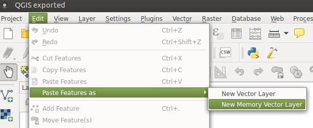
In the upcoming 2.8 you have the copy to memory functionality and you also have a new bit of functionality – create a scratch layer in memory. Scratch layers look like a spatialite layer when they are built. You go to Layer > Create new Layer > Temporary Scratch Layer.
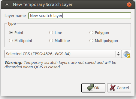
You work. Build. Create. Destroy. All in memory. When you close qgis it’s gone – although you have the ability to save it all out to a file of your choosing. Useful? I think so. Of course I am still a fan of creating a temp directory in a project and throwing things in it to be deleted later. Overall – a very good addition to the 2.8 release.




