- Software: QGIS 3.20
- OS: Any
- Updated: August 2021
This tutorial is going to use some freely available WMTS services at ESRI. I believe the licensing agreement now wants you to be a customer of ESRI to use this service. This is the Imagery WMTS Service.
Go to http://services.arcgisonline.com/ArcGIS/rest/services/World_Imagery/MapServer

If you notice at the top this service is published in several different forms – one of these is a WMTS (highlighted). Click on the WMTS link to get this URL:
Copy the URL from your web browser to your clipboard.
Open QGIS. Select the Open Data Source Manager icon.

Once the WMS/WMTS menu open Click New.

Give the service a name and copy the URL into URL Text Box
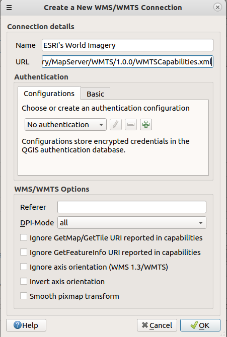
Click OK. Click Connect.
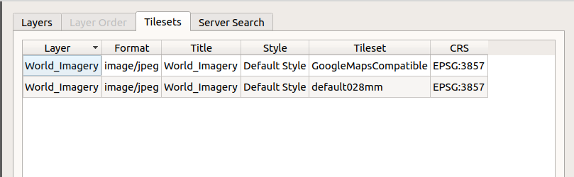
There are two versions of the service. Click the tileset that is “default028mm” and click add.
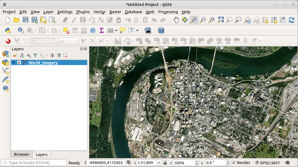
Enjoy your new Image Service
Want QGIS Training? Need help with a project? Give us a shout at info at northrivergeographic.com