I don’t have this one entirely figured out yet – but last night it started making more sense. If you’ve installed QGIS 2.14 you’ve noticed a few things – and one of those might be this icon:
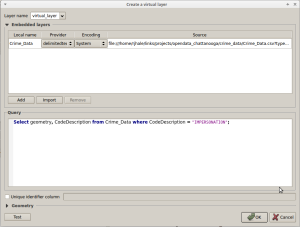
The new icon is for Virtual Layers. Lets add a Text File to my QGIS Session. This file has been mentioned before and is incidents of Crime in and Around Chattanooga. I can import this layer in and start treating like it’s in a database by throwing SQL against it….while it’s still a CSV. From the menu you can do this with several file formats from GPX to KML and Web Services. That will display all incidents of impersonation out of the CSV – sorta like running a select before you display your data.
SOOOOOOOOO what you say…..
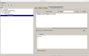
If you look at the DBManager you will see your text file under Virtual Layers. From here you can also go nuts throwing SQL against it like it were in a database.
SOOOOOOOOO what you say……
Like I said – I don’t understand everything going on here…BUT….if I may indulge some crazy at this spot.
- You aren’t converting data to another format
- There’s a certain amount of freedom being exhibited – Your data format doesn’t matter – Just your data.
- Finally – I’m not having to think about shapefiles. 2016 has been my war on shapefiles. I’ve been doing everything I can to avoid the one format. So I’ve been utilizing PostGIS, Spatialite, and am dabbling in Geopackage. Â Here is what I hope is QGIS’s step away from having to work with shapefiles as any intermediate format. Hey – you can always save your data out to shapefile – the world does run off that one format. It would be nice to get the ability to not run to shapefile and it’s slowly happening if you watch the software.
Soooooooooo What……..
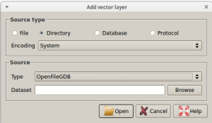
Add your ESRI File Based Geodatabase and start throwing some SQL against that – without diving into a ton of python. I’ve only done this a little – but still. It’s a pretty nifty feature.


