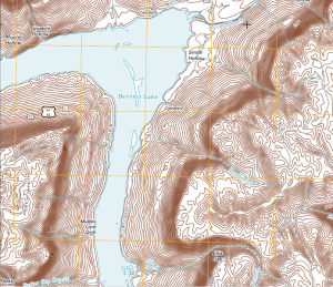
It’s one of the things I always end up falling back to are the USGS 7.5 Minute quad sheet. My forestry clients live and die by them even though they are now getting severely out of date – some as much as 30 years.
I stumbled on this the other day – Google has a map gallery. I knew somewhere in my head they did – but as you can see I use it so infrequently I forgot they had one. They’ve teamed up with the USGS to provide a fairly simple way to download the newer ortho quads . To me (and this is just me) the newer maps, while nice, don’t have the same soul as the old ones. They are nice because they are more up to date – but….SOUL……
Anyway I started looking and immediately downloaded the quadsheet in the screenshot – the Wauhatchie quad since that is in my old (or current) stomping grounds. Well – it’s a GeoPDF. I’m sorta torn about that, but after giving it some thought that might be the best way to deliver these maps to the public. Being a GeoPDF and seeing how it has layers – you can turn off the image if you wish.
Without Image and With Boring Tan Contours
With Image and Boring Tan Contours.
Cool right?
BUT – it’s a PDF.
gdal_translate -of GTiff TN_Wauhatchie_20100512_TM_geo.pdf test_ortho.tif –config GDAL_PDF_DPI 300 -co “COMPRESS=JPEG” -co “JPEG_QUALITY=85”
and your favorite desktop GIS software of choice:
So overall I can get the new ortho quads into GIS desktop software. The tan contours lines don’t lend themselves to great visibility. BUT – this might be a decent addition to some of the work I do. So the point of this story – Arm yourself with GDAL. It does many wonderful things.


