As I sit here starting to lay out this transition I decided I’d better start scribbling a few things down. This isn’t done to make much of a statement. Â This is mostly trying to fix a problem. As I’ve been said in a recent presentation I made – “GIS is flexible if you let it”. Will this work for everyone – I doubt it. For this client It will.
I’ve  a forestry client. Things started getting unholy complicated this year. I wrote a post on moving their data from shapefiles to postgis. I’ve still been using ArcGIS for maps and various things but the data resides in PostGIS. I dump data to shapefiles so they can look at it. Except it’s not a good fix. I don’t wish or want to dump data to shapefiles. Things get changed and I’m left trying to move the changes back into postgis. So I really want to get them editing the data as it resides on their system.
I started this morning laying out a plan. It’s gotten complicated in the last 20 minutes. You can’t eat an elephant whole…and I can’t fix this all at once. So we’re going to piecemeal it all together.
Lets kick this off where the problems started. Maps. This time last year NRGS got a fairly complicated request for maps. The forestry client manages about 30,000 acres of land. There are multiple disconnected polygons scattered over multiple counties and two states (but only one projection). The mapbook went from something that was two button clicks in Data Driven Pages to a 10 hour slog of exporting the changes for a few weeks. It wasn’t automated. It couldn’t be with all the individual changes we had to make per map. When you work with a client enough you get a feeling sometimes. I’ve got a feeling these maps are about to make another appearance. I want this to work easier with Postgis.
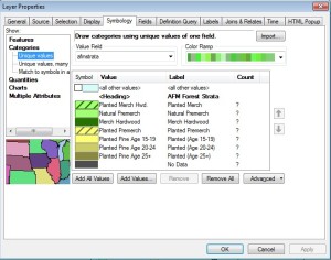
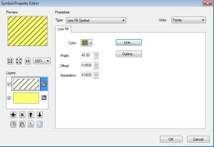
The first thing I’m doing is migrating my symbology. There is some not overly complicated symbology – but it’s nice symbology for these datasets. It’s not harsh…a bit green. Green is good though. The worst one is the stands layer. I opened ArcGIS and got started.
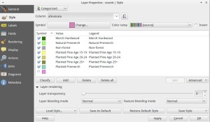
I was able to do this in QGIS 2.6 in about 15 minutes.
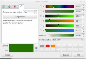
Color wise it’s a duplicate (except for one attribute – I’m getting to that one). Colors palettes aren’t 1:1. ESRI has there way of doing it and QGIS has it’s way. I typed the first few RGB values in by hand. I then found in QGIS 2.6:
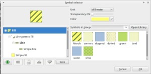
QGIS has a color picker. So I just worked my way down the line and changed the fill and the border colors to be identical. That only left me with one “diagonal issue”. One of my symbols in arcgis was a diagonal fill. There is enough flexibility in QGIS 2.6 you can recreate that also. You add a line pattern fill and add a simple fill and thanks to the color picker:
Granted it’s not quite perfect – BUT – it’s close. Very Very close. Line weights don’t quite equal. A lines weight of 5 in ArcGIS appears to be about a 2 or 3 in QGIS. The way the map renders looks a bit different but I’m also jumping across platforms and Virtual Machines and things.
So symbology has transitioned. Next question is Atlas vs Data driven Pages. Can I take something that we had to individually change in Data Driven Pages and automate it in Atlas? I dunno. Half of me says yes…other half says no. The important thing to remember is for this client – this is all being done with 100% free and open source software. Could I have done this 5 years ago. Nope. Partially maturity of software and partially I was hung up on one solution. Now…It’s happening.
I’m saving everything as a qml and sld in qgis. I’m hedging my bets and saving all my ArcGIS symbology as a lyr.
Stay tuned as we tackle more issues such as connecting three other workstations to this database, “stop turning off your computer”, and my favorite – Can we get some static IP addresses on the network please.

