So in today’s “Learn something new” and “don’t limit yourself to one tool” – gvSIG. I’m horrible about finding something thought and wearing it out. I did that with ArcGIS/ArcINFO for the first 23 (Holy Crap) years and now I’m doing it with QGIS. I do love me some QGIS though.
So – one more tool it doesn’t hurt to have around is gvSIG. GvSIG has been around for a while – from Wikipedia “The first part of the abbreviation stands for Generalitat Valenciana, the Spanish regional authority that the system was originally developed for. The latter part, SIG, is the Spanish equivalent for the English GIS.”
If you go back a few posts I did a post on OpenJump. GvSIG isn’t terribly different in some regards. Multiple Views. It’s built on Java. It has Sextante built in as it’s geoprocessing module.
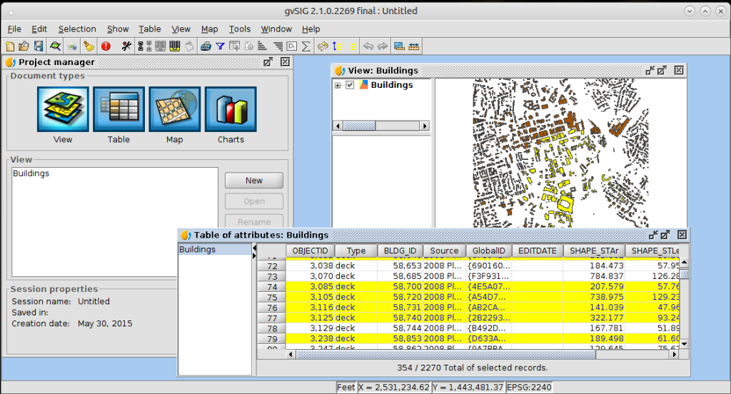
It did take a bit more work to add some data than I’m used to – but it’s not hard by any stretch. You create a new view. You set the projection of that view. You add data to the view (right click in the upper left rectangle of a view) and in my case I also had to set the projection of the data. GvSIG didn’t recognize the projection and I had to define it. Once defined everything was good. Right clicks make the world go round – so to change the properties of any data layer you add just right click.
Probably the thing that surprised me the most in my American-Barely-Spanish-Literate self is this program (while having been translated into several languages) has most everything in Spanish. My english version still has a few dialog boxes that are in spanish. If you do any amount of searching you see the community is quite extensive and they have an outreach site and educational material. You’ll even notice with some more digging that their last Conference was numbered 10 and was held last year in Spain. You’ll also notice a large Latin American/South American/Spanish representation through out the site.
Is gvSIG any less significant than anything else? No. Not if you are worried about your data. You can do all your normal GIS tasks and then some with this piece of software. You can even make a map which has a one up on OpenJump. I still like QGIS – but it doesn’t hurt to have another piece of GIS software at your disposal.
I have installed 2.1 – and from what I can gather 2.2 is just around the corner.
So go out and learn something new – download gvSIG and explore some new software. You might find you like it, want to join the community , and maybe donate some money or time into making the software better.


