I know – I’m running behind. So look at these 12 days as either “hints” or “tools”….or both. Being a consultant I walk into some weird situations with data and clients – so it helps to take a full complement of tools into a situation….and a good attitude but that’s on Day 12.
So what do I give you on day 3? GRASS. Yeah and it’s the running joke EVERY.SINGLE.TIME. “I tried GRASS back in College”.
If GDAL is a swiss army knife and QGIS is my hatchet – this is my sledgehammer. I may not use it as much as I need to – but when I need it it works oh so well.

Don’t worry it’s got a GUI
GRASS has been under some form of development since 1982. It was opened up in the mid 90’s and it’s still actively developed today. Python friendly. Command line friendly. It has it all – even a friendly gui so you can push buttons.

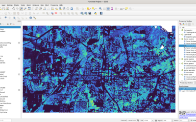
So what do I use it for? If you’re an active QGIS user you’ll see a lot of the tools exposed in the processing toolbox. You can gleefully play along with it there if you wish. I would encourage you to look at the tutorials the community has provided. If you’re dealing with a lot of raster data it’s pretty awesome. I’ve used it for drive time analysis with vector data. My one secret weapon with vector data has been the topology tools. If I receive some really bad vector data I’ll import it into GRASS and clean it up. Yes – for those of you that miss clean and build from your workstation days you can relive some of that excitement here.
A couple of years ago I had a call from a drone company. They wanted to leverage their raster data beyond the commercial software they were using. They wanted multiple products with multiple use cases and a lot of clients all from a server out in the “cloud”. My answer? Something really complicated involving some weird process? No – the Second worst programmer in existence (me) hammered out a process leveraging GRASS and python. We were adding and subtracting elevation models after some hefty discussion using the processes found in GRASS. which to me was somewhat poetic – this, probably the oldest piece of software I use, was working with Drones, probably the most disruptive thing to hit aerial imagery collection in forever.
Right now I’ve been using it with LIDAR data. TN freed up a lot of LIDAR data (points and a surface model) for people to work with. I have been known to download the data and mosaic it with GRASS. I’ve played with point clouds in here also. One of the best thing about GRASS is it’s rock solid. I’ve not crashed it often and I really have to do something super stupid to make it go down. If I want to toss a few hundred GB of raster data at it that’s fine as it will churn through that data without blinking.
On Day 3 – Try the Geographic Resources Analysis Support System software. The Ultimate why?
Captain Kirk said so….